See More From Above
With over 30 years of aviation experience, Aerial Intelligence is a clear choice for all your UAV needs. We pride ourselves on our aviation safety procedures and our ability to make your project worry free.
Expert Crews.
Expert Equipment.
Expert Results.
At Aerial Intelligence, our top priority is to provide our customers with a quality product. We strive to deliver excellent results, regardless of the location of each structure.
Aerial Intelligence Is Hiring!
We are looking for drivers, camera operators, and pilots in the Denver Metro area!
We are looking for Part 107 Certified Pilots with quadcopter experience. We are happy to answer any questions you may have in detail, so don't hesitate to get in touch via email, phone, or social media.
So what are you waiting for? Get outside and come fly with us!
I'm Interested!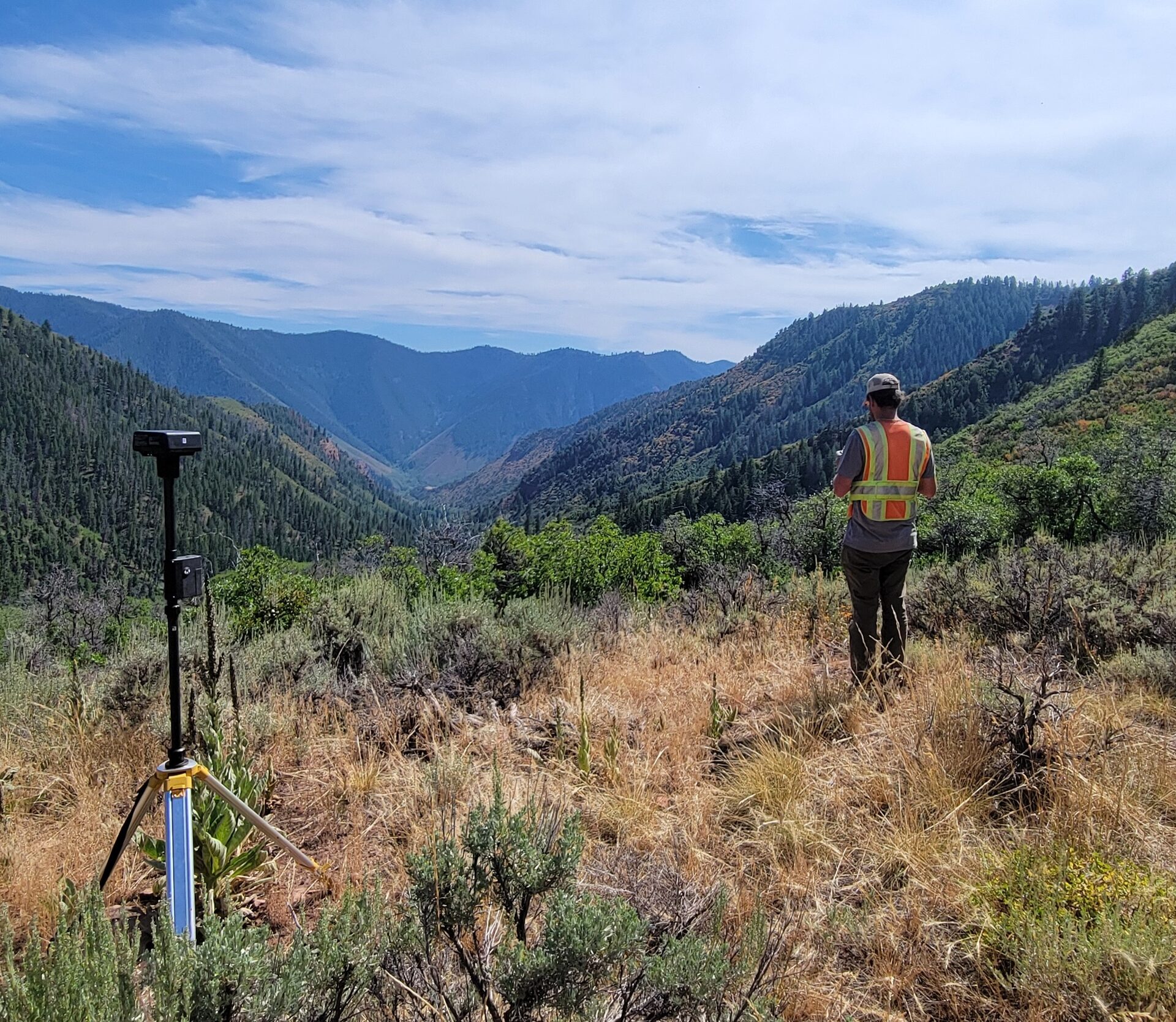
Transform the way you inspect and manage your assets.
We believe that our use of Unmanned Aerial Systems (UAS) allow our crews to deliver substantially more data rich inspections to you, our customer. We also provide data in a fraction of the time compared to traditional inspection methods, and we are happy to prove it!
However, all the data we collect is useless without good inspection software. Large inspections can generate terabytes of data and quickly become a nightmare if not managed properly. Our solution lets you intuitively view every photo we take of your structures, track any faults or damage we find, filter down to the issues that concern you most, record when they're resolved, and improve your bottom line.
Give Us A CallPerspective Advantage
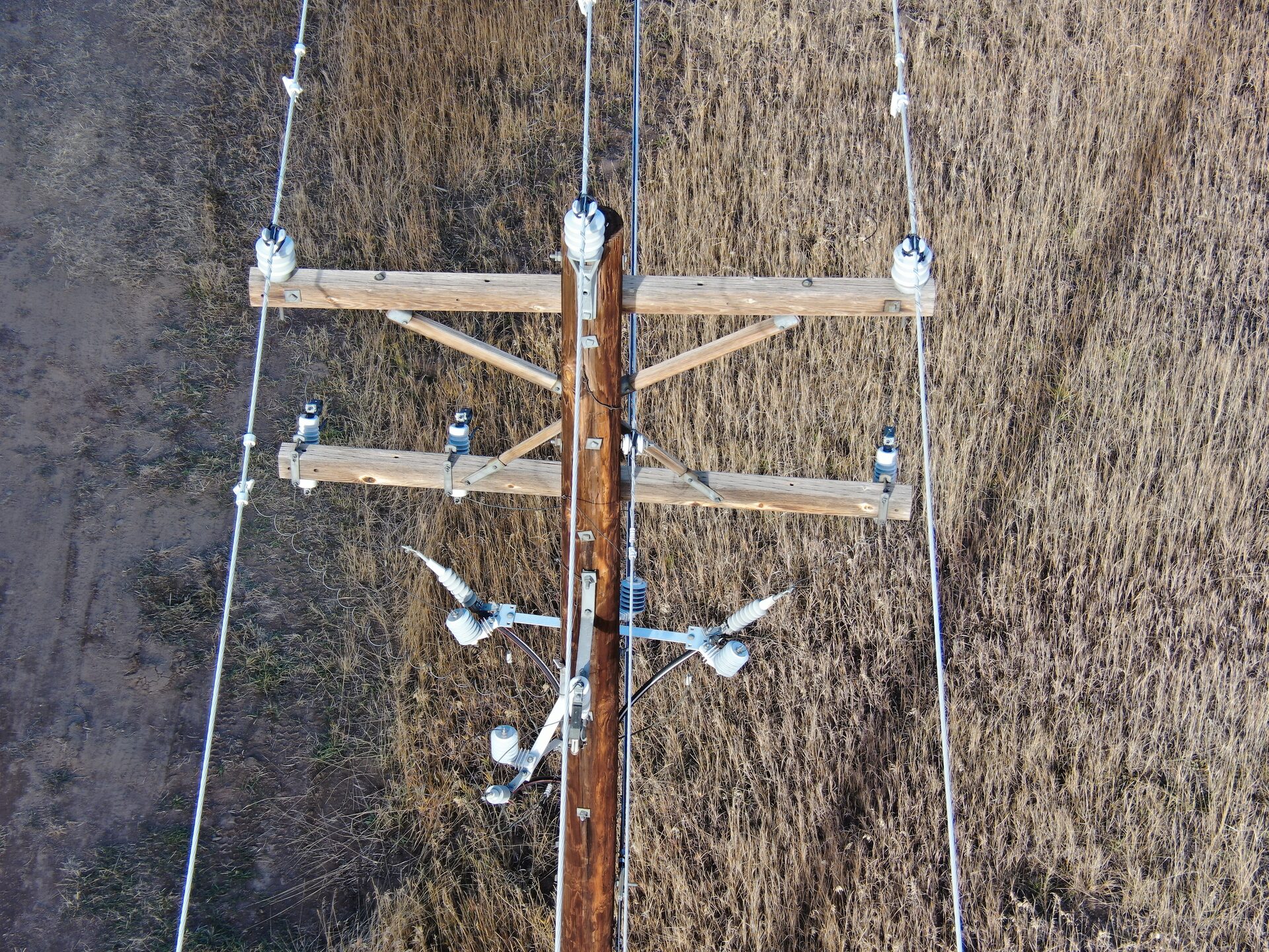
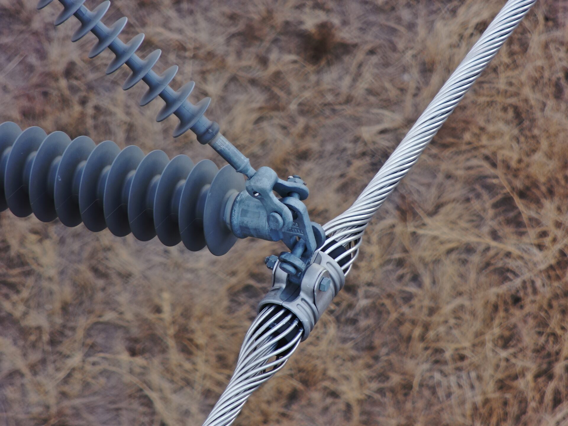
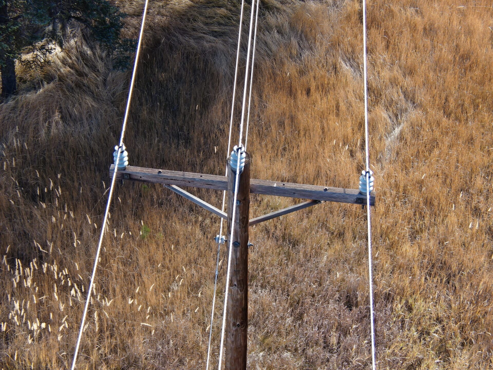
Don't settle for an inspection that only includes the bottom of your structures. Drones allow our crews to see angles that are inaccessible to maintenance crews looking up from the ground.
Rough Terrain
Colorado is home to the beautiful Rocky Mountains. Our aerial crews can quickly photograph a large amount of structures that are in hard-to-reach places for traditional inspection crews.
Fast & Accurate
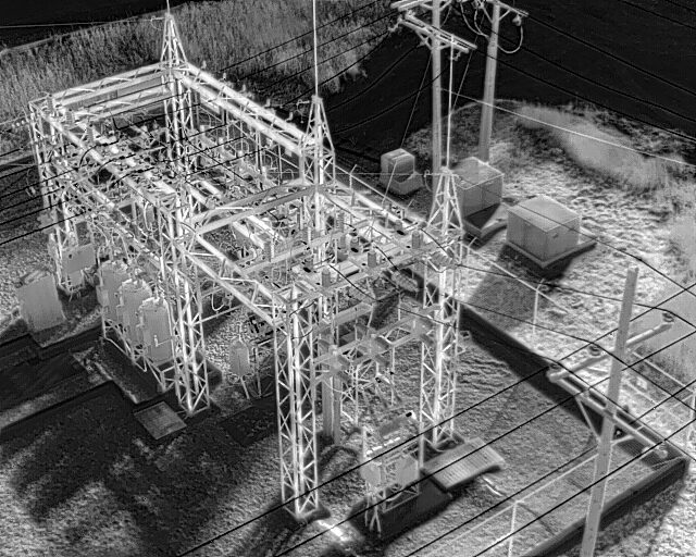
A combination of high-resolution photos, thermal imagery, and robust software to manage large amounts of data ensure our crews deliver superior inspections in a fraction of the time.
What We Do.
We excel at visual and thermal inspections of power lines, but our capabilities extend far beyond that. Please contact us for more info about how we can aid you with your next project or inspection.
The Best The Industry Has To Offer
The UAS platforms deployed by Aerial Intelligence are designed to tackle big jobs in less than ideal conditions. A high tolerance for the elements and an arsenal of technology are what allow us to provide an excellent product in harsh mountain environments. Here are just a few of the features that help our crews capture the data you need:
- 30+ minute flight times
- 20 megapixel camera for high detail photos.
- Over 20x optical zoom
- High resolution thermal camera can find faults not visible to the naked eye.
- Ability to withstand winds in excess of 30 mph.
- IP45 intrusion rating.
- Capability to carry LiDAR sensors.
Interested in working with us?
Please contact us using one of the methods below!